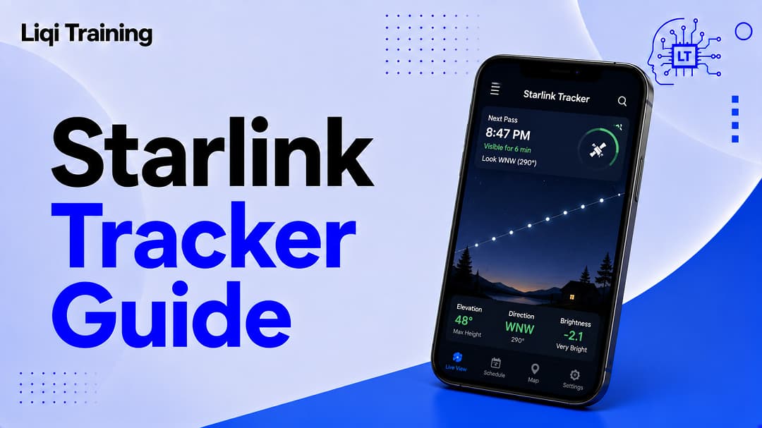
A Starlink tracker predicts when Starlink satellites will pass over your location. Satellites are easiest to see shortly after launch, when they travel in a “satellite train.” Visibility depends on sunlight, weather, local light pollution, and your geographic location. Most tracking websites allow you to search by city or GPS coordinates. Starlink satellites do not produce their own light, they become visible by reflecting sunlight.
Watching a line of bright lights glide silently across the night sky is an unforgettable experience. For many people, the first sight of a Starlink satellite train raises more questions than answers. Is it a meteor? A group of drones? Or something far more unusual?
In most cases, the answer is much simpler, you’re likely seeing newly launched Starlink satellites traveling together before spreading into their operational positions. Fortunately, you don’t have to rely on luck to witness this phenomenon. Modern Starlink tracker tools can predict exactly when satellites will pass over your location, the direction they’ll appear from, how bright they may be, and how long they’ll remain visible.
This guide explains how Starlink tracking works, the best tools available, what makes satellites visible, and how to improve your chances of seeing them with the naked eye.
What Is a Starlink Tracker?
A Starlink tracker is an online tool or mobile application that predicts the location of Starlink satellites as they orbit Earth.
Using continuously updated orbital data, these trackers estimate:
- When satellites will appear
- The direction they’ll travel
- Maximum elevation above the horizon
- Expected visibility
- Duration of each pass
Some advanced trackers also display live satellite maps, three-dimensional orbital models, and real-time satellite positions.
Unlike astronomy apps that focus on stars and planets, Starlink trackers specifically monitor the growing Starlink constellation.
Why Are People Tracking Starlink Satellites?
Interest in Starlink tracking has grown rapidly because the satellites create one of the most unusual sights visible without a telescope.
Many skywatchers use trackers to:
- Watch newly launched satellite trains
- Learn more about space technology
- Photograph satellite passes
- Observe satellite movement
- Plan astronomy sessions
- Teach children about space and satellites
For photographers, knowing the exact time and direction of a pass can mean the difference between capturing a spectacular image and missing the event entirely.
How Starlink Trackers Work
Every satellite follows a predictable orbit around Earth.
Tracking platforms combine orbital elements with your location to calculate when a satellite will rise above your horizon.
A typical prediction includes:
- Start time
- Peak visibility
- Direction of travel
- Maximum altitude
- End time
- Brightness estimate
Because satellites continuously move, these predictions are updated regularly using the latest orbital information.
The Best Time to See Starlink Satellites
Many first-time observers expect satellites to be visible throughout the night.
In reality, timing is everything.
The best viewing opportunities usually occur:
- Shortly after sunset
- Shortly before sunrise
During these periods, your location is dark enough to see the sky while the satellites remain illuminated by sunlight above Earth.
Later in the night, satellites often move into Earth’s shadow, making them much harder to see.
Understanding the Starlink Satellite Train
One of the biggest attractions for skywatchers is the famous Starlink satellite train.
Immediately after launch, dozens of satellites travel together in a straight line before gradually separating over the following days and weeks.
This creates the distinctive “string of pearls” appearance that frequently surprises observers.
Once each satellite reaches its assigned orbit, the train effect disappears, making individual satellites much harder to identify.
What You Need Before Tracking Starlink
Successful satellite viewing doesn’t require expensive equipment.
You’ll simply need:
- A clear sky
- Minimal cloud cover
- Low light pollution
- An accurate Starlink tracker
- A viewing location with an open horizon
Rural locations generally offer much better viewing conditions than brightly lit cities.
Popular Starlink Tracking Websites
Several websites provide reliable Starlink predictions.
Find Starlink
One of the easiest tools for beginners.
Simply enter your location to receive predicted viewing times and directions.
TrackStarlink
Offers live satellite positions, coverage maps, launch information, and real-time orbital data.
Heavens-Above
A long-established satellite tracking platform that predicts visible passes for numerous satellites, including Starlink launches.
Can You Track Individual Starlink Satellites?
Yes.
Several tracking services allow users to select individual satellites and view:
- Current location
- Orbital altitude
- Ground track
- Velocity
- NORAD identification
- Launch history
These features are particularly useful for researchers, satellite enthusiasts, and advanced observers.
Why Aren’t Starlink Satellites Always Visible?
A common misconception is that satellites are always easy to spot.
Several factors determine visibility.
Sunlight
Satellites only become visible when they reflect sunlight toward the observer.
Weather
Clouds, fog, and rain can completely obscure satellite passes.
Light Pollution
Urban lighting significantly reduces visibility.
Satellite Position
Many satellites are simply too faint to see once they reach operational orbit.
Can You Track Starlink From Your Phone?
Yes.
Many tracking platforms work directly through mobile browsers, while astronomy applications may include Starlink pass predictions.
Most mobile-friendly trackers use your GPS location to automatically calculate upcoming satellite passes.
This removes the need to manually enter coordinates.
Are Starlink Satellites Visible Everywhere?
Starlink satellites orbit Earth continuously, but visibility differs depending on:
- Latitude
- Time of year
- Local weather
- Twilight conditions
- Recent launches
Observers at higher latitudes often experience more frequent viewing opportunities than those closer to the equator.
Tips for Better Starlink Viewing
A little preparation greatly improves your chances of success.
Choose a location with an unobstructed horizon.
Arrive several minutes before the predicted pass.
Allow your eyes to adjust to the darkness.
Avoid looking at bright phone screens immediately before viewing.
If photographing satellites, use a tripod and a longer exposure to capture the trail.
Starlink Tracker vs. Starlink Coverage Map
These two tools serve different purposes.
A Starlink tracker predicts where satellites will appear in the sky.
A coverage map shows where Starlink internet service is available or planned.
If you’re researching internet availability rather than satellite visibility, read Starlink Internet Explained: Speeds, Coverage, Setup, Pricing, and Pros & Cons.
Common Tracking Mistakes
Many beginners accidentally reduce their chances of seeing satellites.
Some of the most common mistakes include:
- Looking too late after sunset
- Choosing heavily light-polluted locations
- Ignoring cloud forecasts
- Expecting operational satellites to appear as bright trains
- Using outdated tracking information
Modern tracking websites update orbital predictions frequently, making current data much more reliable.
Frequently Asked Questions
Are Starlink satellites visible every night?
Not necessarily. Visibility depends on your location, weather, satellite position, and lighting conditions.
Can I see Starlink without a telescope?
Yes. Newly launched satellite trains are often visible to the naked eye under favorable conditions.
Why can’t I find the satellites even though the tracker says they’re overhead?
Cloud cover, bright city lights, or satellites passing through Earth’s shadow can prevent visibility.
Are Starlink trackers free?
Many of the most popular tracking websites provide free access to pass predictions and live satellite maps.
How accurate are Starlink trackers?
Most are highly accurate because they rely on regularly updated orbital data, although weather and visibility conditions still affect what you can actually see.
Continue Learning About Starlink
If you’re exploring the entire Starlink ecosystem, these guides complement this article:
- What Is Starlink? How SpaceX’s Satellite Internet Works and Who Should Use It
- Starlink Internet Explained: Speeds, Coverage, Setup, Pricing, and Pros & Cons
- Starlink Cost: Equipment Prices, Monthly Plans, Hidden Fees, and Value Explained
- Starlink Mini Review: Features, Speed, Battery Options, Pricing, and Is It Worth Buying?
- Starlink Outage Guide: Common Causes, Live Status, Troubleshooting, and How to Report Problems
Conclusion
Starlink trackers make satellite spotting accessible to anyone with an internet connection and a clear view of the night sky. By combining your location with up-to-date orbital data, these tools can accurately predict when Starlink satellites will pass overhead, helping both casual observers and astronomy enthusiasts plan successful viewing sessions.
Whether your goal is to witness a newly launched satellite train, photograph satellites crossing the sky, or simply better understand the world’s largest low-Earth-orbit satellite constellation, a reliable tracker removes the guesswork. As the Starlink network continues to grow, tracking tools are also evolving with more accurate predictions, live maps, and mobile-friendly features, making it easier than ever to explore the technology behind SpaceX’s global satellite internet system.
ADVERTISEMENT